Travel and Exploration
Special Collections has a number of materials related to travel and exploration. The three largest holdings consist of around 400 travelogues and other published accounts of travel throughout Europe, approximately 100 of which focus on travel within Great Britain; around 150 titles related to travel in North and South America, including emigrants’ guides, sea expeditions, and published accounts of western expansion; and a collection of maps and atlases dating from the 16th century to the present.
How to Use the Collection
With a few exceptions, the collections can be accessed and requested through the library catalog. Finding aids for individual collections are linked on this website. Materials are available for use in the Special Collections Reading Room (room 401) during regular hours. Materials do not circulate.
Finding Aids for Travel and Exploration
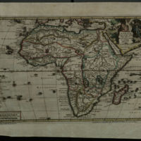
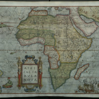
Gary E. and Janet J. Venable Antiquarian Atlas & Map Collection
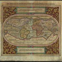
The Venable Collection documents the history of cartography, geography, and exploration from the sixteenth through the early twentieth century.…
John G. Neihardt Collection.
Biographical Sketch John Gneisenau Neihardt (1881-1973) accepted a position at the University of Missouri-Columbia's Department of English in 1949…
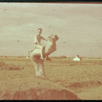
Martin and Margaret Hiller Collection of Audiovisual Materials on China, 1945-1948.
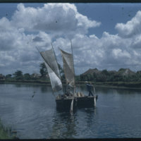
Scope and Contents The Hiller Collection documents cities, industries, farming, and everyday life in China during the second phase of the Chinese…
Rare Books
The Rare Books Collection is the default designation for materials in Special Collections that are acquired as individual items. Like Special…
War Poster Collection.
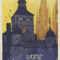
Scope and Contents The collection consists of posters from both World War I and World War II with tourist and other miscellaneous posters from the…
William Least Heat-Moon Papers.
Scope and Contents Material by Wililam Least Heat-Moon (b. 1939). Manuscripts and additional materials from the following books: PrairyErth (A…
Related Exhibits
Hiller Collection
The Hiller Collection documents cities, industries, farming, and everyday life in China during the second phase of the Chinese Civil...
Leaders and Heroes 2: The Arts
This exhibit was born out of a desire to showcase materials within Special Collections at the University of Missouri that...
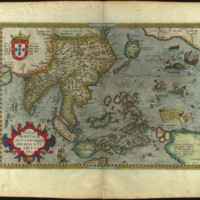
Places in the World: Treasures from the Venable Collection
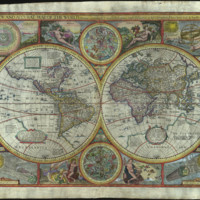
Maps tell us where we are. The most obvious way they do this is geographical, but there is also a...
Selected Items
Hiller 09-047 : Linggu Pagoda in Nanking
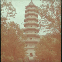
Photograph of the Linggu pagoda of Linggu Temple. Linggu Pagoda was built in 1930 to 1932 to commemorate the soldiers who lost their lives during the…
Hiller 09-099 : Standing people with umbrellas and hats
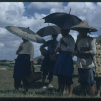
Photograph of standing people with umbrellas and hats in Soochow.
Digitized from glass slide. Quality of original is good. Scan: Creo iQsmart3.…
A Statistical Map of Missouri Showing Manufacturing and Mechanical Industries by Counties. With A Soil and Mineral Map of Missouri Showing the Principal Soil Areas and the Regions of Coal, Lead, and Zinc.
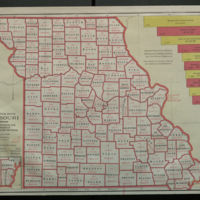
On the reverse: A Soil and Mineral Map of Missouri.
Hiller 09-035: Sun Yat-sen Mausoleum in Nanking 1
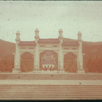
Photograph of Sun Yatsen Mausoleum. The photo looks orange.
Digitized from glass slide. Quality of original is fair. Scan: Creo iQsmart3. Image…
Hiller 09-060 : Standing lion statue on Elephant Road in Ming Xiaoling Mausoleum
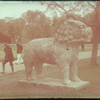
Photograph of Standing lion on Stone Elephant Road in Ming Xiaoling Mausoleum. Two walking people are looking at it. The photo looks little…