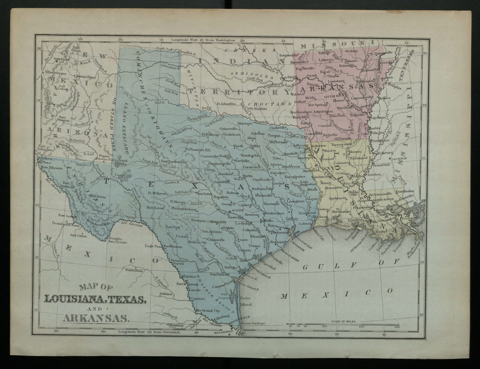
Map of Louisiana, Texas, and Arkansas.

Information About This Item
Creator
Mitchell, S. Augustus 1792-1868. (Samuel Augustus)
Title
Map of Louisiana, Texas, and Arkansas.
Publisher
[Philadelphia] : [Butler]
Date
1873-1883?
Description
Shows cities, railroads, military outposts, areas of Indian habitation, and geographic features for Texas, Arkansas, Louisiana, and a portion of New Mexico and Indian Territory.
Relation
Identifier
OCLC: 228497229
Source
From an edition of S.A. Mitchell's A system of modern geography (His New intermediate geography, Bk, 3), published by Butler in Philadelphia.
Format
1 map : color ; 21 x 27 cm on sheet 24 x 29 cm
Type
Map.
Coverage
United States.