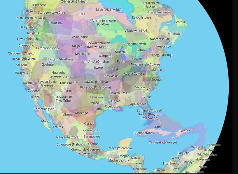
Native Land Digital is an interactive, global map that provides historical information about Indigenous people, territories, languages and treaties as well as linking to current tribal affiliations.
Users can click on labels across the Americas and around other parts of the globe — or type a specific city, state or zip code into the search box — to see which Indigenous tribes lived where. You can zoom in or out, as well as choose to apply “settler labels” to see how the map corresponds with contemporary state lines. Clicking on the name of each nation brings up links for related reading.
Not only can you use it for personal use, it can also be used as a teaching resource for your courses. Be sure to check out the teacher’s guide on their website. Another nice feature of this interactive map is the app version making it easy to look up what lands you are when traveling.